“ Remote sensing based system for forest risk factor monitoring (Forest Risk)”
Agreement with Central Financing and Contracting Agency (CFCA) Nr.1.1.1.1/21/A/40
Scientific manager: Dr.sc.comp. Ints Mednieks
Project objective: to develop software tools for assessment, monitoring and alerting of forest risk factors using satellite and unmanned aerial vehicle (UAV) based remote sensing.
Project will be performed in partnership of research organizations Institute of Electronics and
Computer Science (EDI) and Latvian State Forest Research Institute (LSFRI) “Silava” (Silava)
with SME SIA Baltic Satellite Service (BSS).
Main activities of the project include:
- Development of methods, algorithms and a prototype system for screening of forests from satellite (synthetic aperture radar (SAR) and multispectral (MS)) data for detection of areas suspected to be at the risk of disturbances.
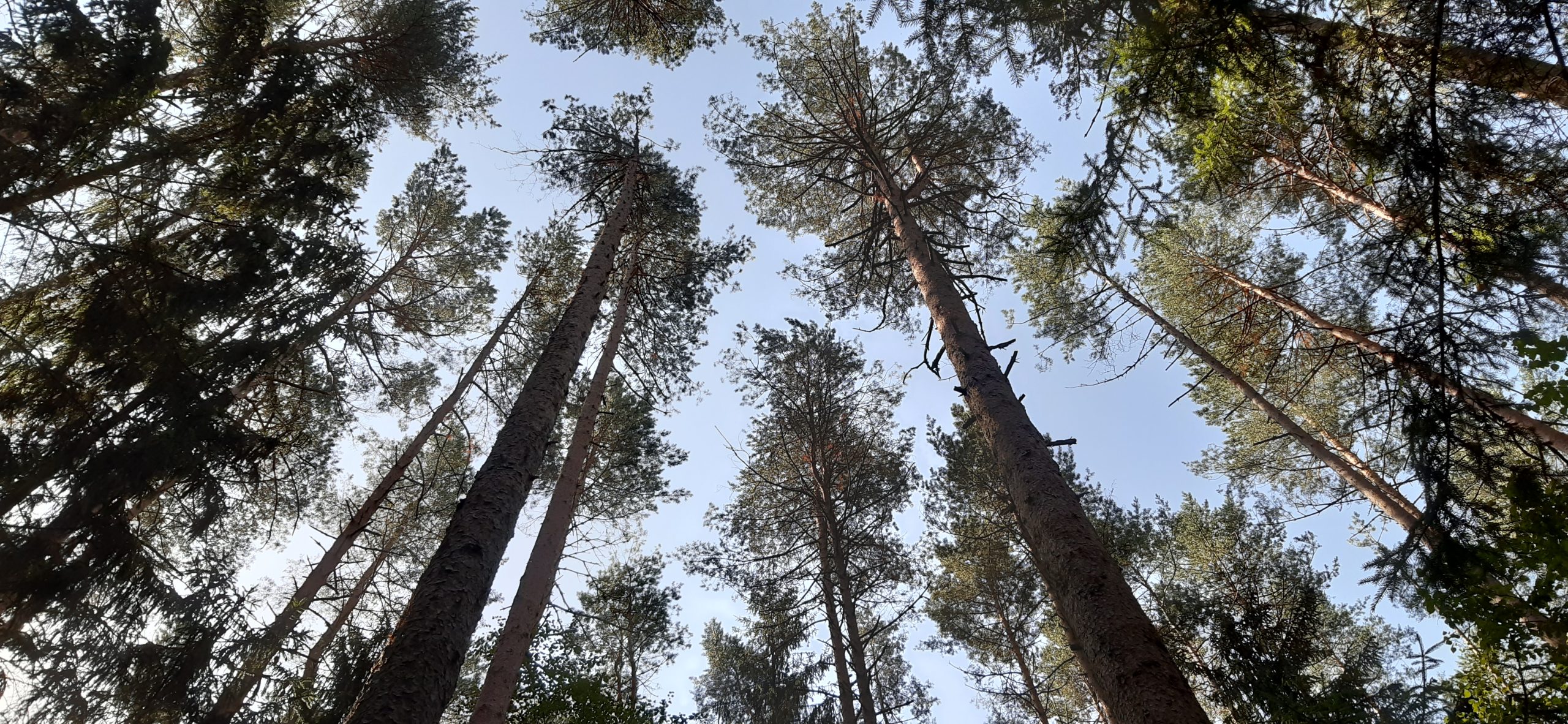
- Performing field surveys and collection of very high resolution (VHR) data of forest areas under the risk of disturbances using unmanned aerial vehicles (UAV).
- Development of methods, algorithms and a prototype technology for detection of forest areas under the risk of disturbances from VHR remote sensing data and for identifying and alerting on potential risk factors using auxiliary data.
- Project management and dissemination of results.
25.05.2022. Interviews with 10 Latvian organizations related to forest health were conducted to find out their opinion on the use of remote sensing for forest risk identification and analysis, as well as the possibility of using specialised software for this purpose.
30.06.2022. A progress report for the 1. phase (01.03.2022. – 31.05.2022) has been submitted
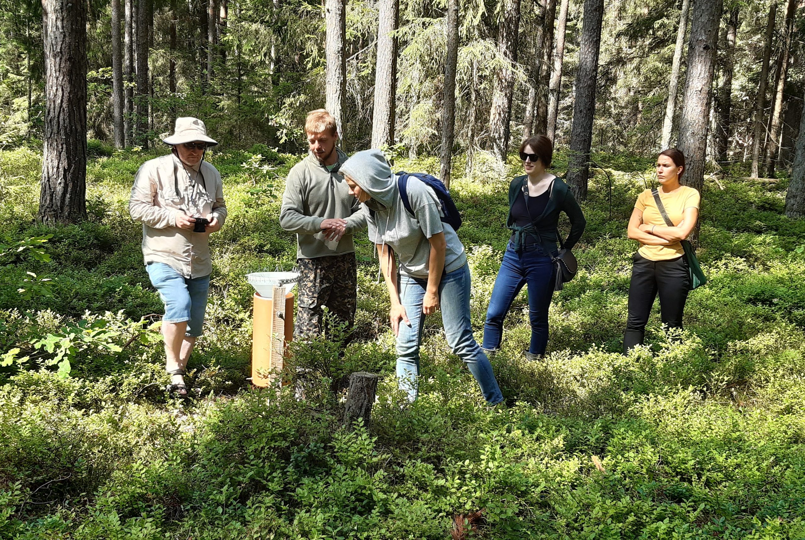
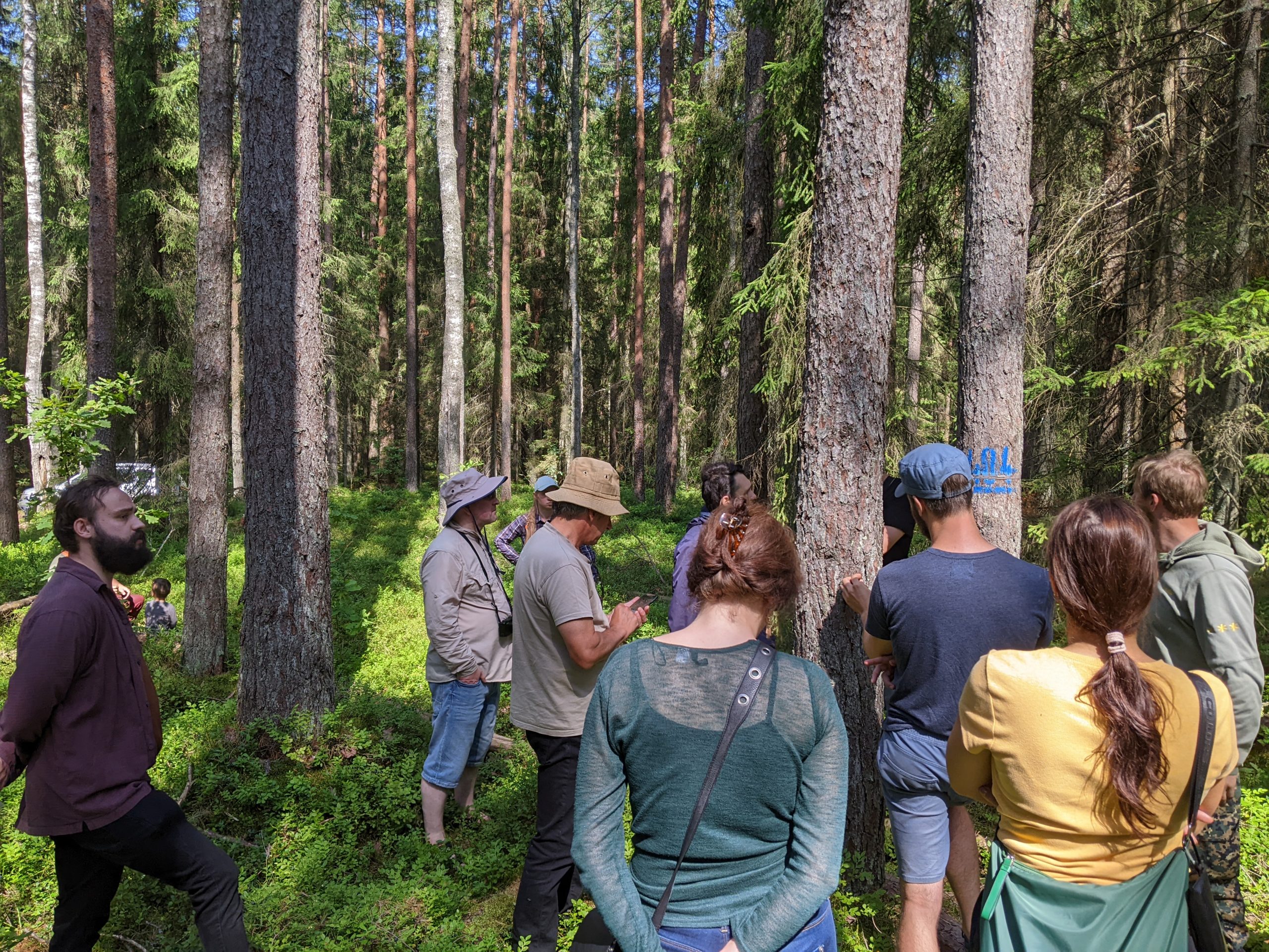
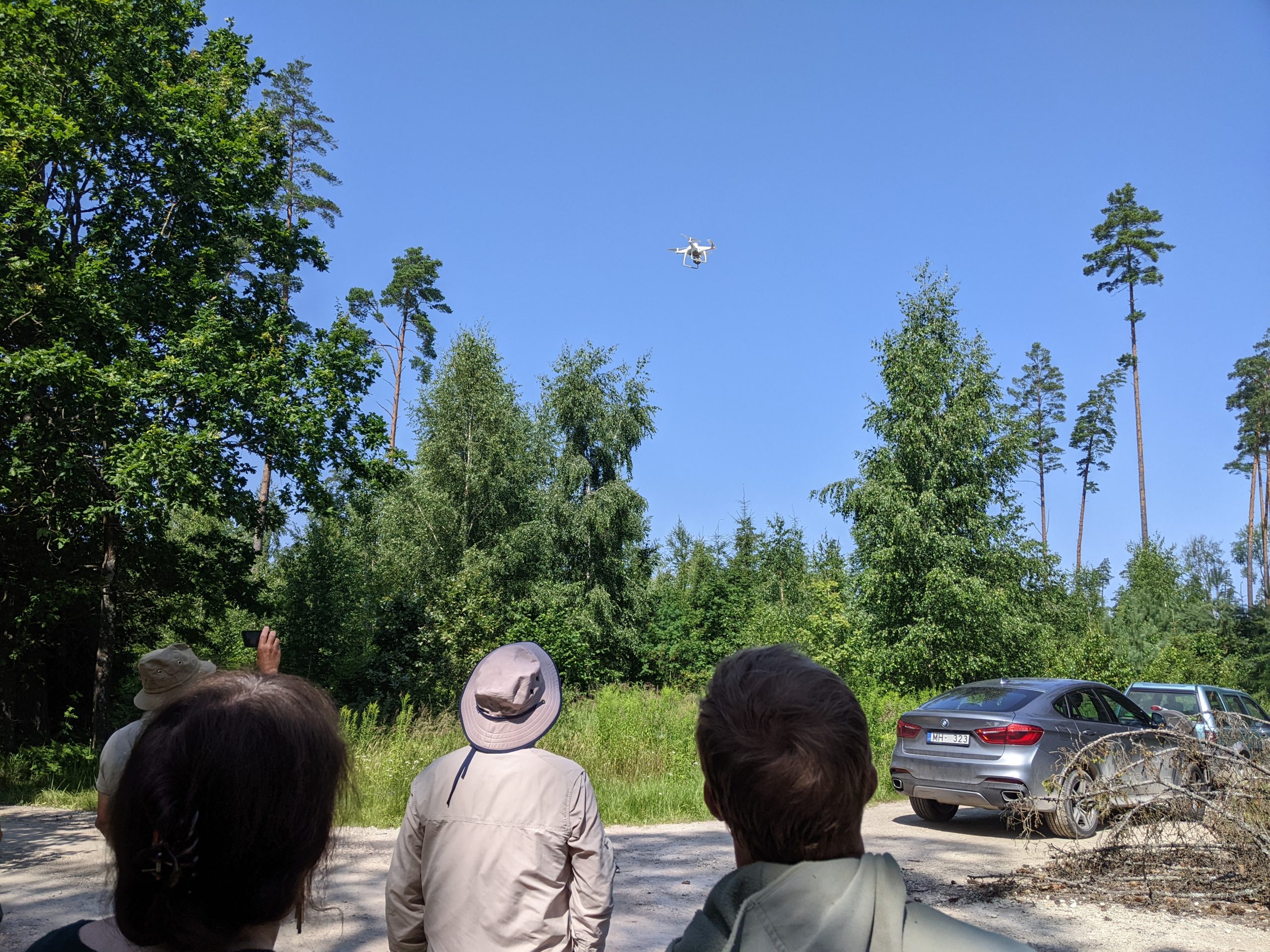
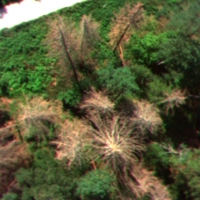
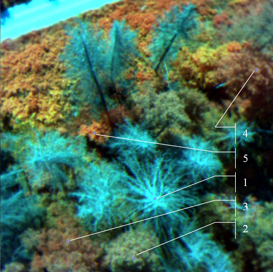
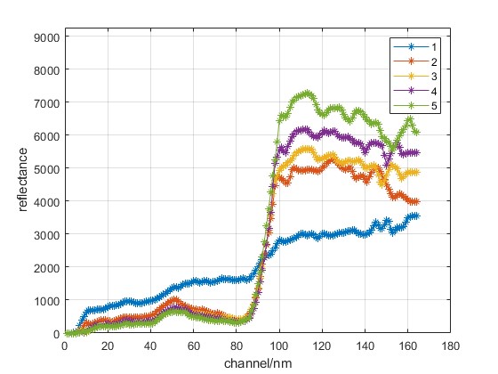
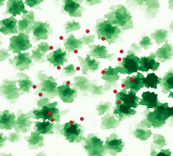
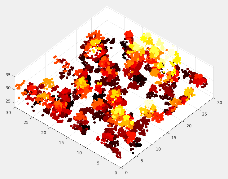
21.07.2022. Project “Remote Sensing-based Forest Risk Monitoring System (Forest Risk)”. Field data collection with UAV and the hyperspectral camera was performed in Valgundes parish together with colleagues from Latvian State Forest Research Institute “Silava” and SIA “Baltic Satellite Service”
Sample captured hyperspectral image
28.09.2022. A progress report for the 2nd phase (01.06.2022. – 31.08.2022) submitted.
21.10.2022. The 2022 data collection campaign in Valgunde district completed and data pre-processing started.
27.01.2023. A progress report for the 3nd phase (01.09.2022. – 31.12.2022) submitted
27.03.2023. Project seminar; https://makonis.edi.lv/s/WTzdgRYR4WaNr67
26.04.2023. A progress report for the 4nd phase (01.01.2023. – 31.03.2023) submitted.
31.05.2023. Project in remote monitoring of implementation.
Publications
J.Sinica-Sinavskis and G. Grube, “Forest Stand Volume Estimation by Species from Sentinel-2 and LiDAR Data Using Regression Models,” 2022 18th Biennial Baltic Electronics Conference (BEC), Tallinn, Estonia, 2022, pp. 1-5. DOI:10.1109/BEC56180.2022.9935590; https://ieeexplore.ieee.org/document/9935590
G.Goldbergs. Comparison of Canopy Height Metrics from Airborne Laser Scanner and Aerial/Satellite Stereo Imagery to Assess the Growing Stock of Hemiboreal Forests. Remote Sens. 2023, 15(6), 1688; https://doi.org/10.3390/rs15061688
Jānis Ivanovs, Mait Lang, Andis Lazdiņš, “The influence of forest tree species composition on the forest height predicted from airborne laser scanning data – A case study in Latvia”. Vol. 29 No. 1 (2023): Baltic Forestry; https://balticforestryojs.lammc.lt/ojs/index.php/BF/article/view/663
Martins Pukitis, Ints Mednieks, “Classification of satellite images using Dynland technology,” Proc. SPIE 12786, Ninth International Conference on Remote Sensing and Geoinformation of the Environment (RSCy2023), 127860E (21 September 2023); https://doi.org/10.1117/12.2681896
Grigorijs Goldbergs and Emīls Mārtiņš Upenieks “Hierarchical Integration of UAS and Sentinel-2 Imagery for Spruce Bark Beetle Grey-Attack Detection by Vegetation Index Thresholding Approach”. MDPI; Journal: Forests, 2024; Volume: 15; Number: 644. Manuscript ID: forests-2908580; doi: 10.3390/f15040644. Link: https://www.mdpi.com/1999-4907/15/4/644
Conference
J.Sinica-Sinavskis and G. Grube, “Forest Stand Volume Estimation by Species from Sentinel-2 and LiDAR Data Using Regression Models,” 2022 18th Biennial Baltic Electronics Conference (BEC), Tallinn, Estonia, October 4-6, 2022.
Martins Pukitis, Ints Mednieks “Classification of satellite images using Dynland technology” „Ninth International Conference on Remote Sensing and Geoinformation of Environment (RSCy2023)” 3-5 April, 2023 – Cyprus.
Janis Ivanovs, Mait Lang “Impact of different tree species composition and seasonality on forest stand height predictions using airborne laser scanning and National forest inventory data”, EGU General Assembly 2023, Vienna, Austria 23-28 April 2023.
Participating scientists


Dr.sc.comp. Juris Siņica-Siņavskis
Software engineer